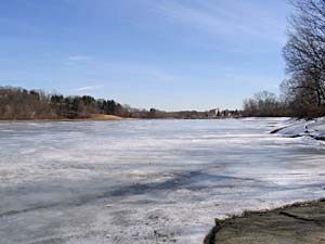
Coes Reservoir is located about a mile from campus and was originally constructed as a source
of water power for the former Coes Knife Company. The dam at the reservoir's southern end has
been at risk of failing for a number of years and is now being reconstructed. The reservoir's
water level has been drawn down by 5 feet for the dam reconstruction project, exposing much of
what normally lies beneath it's surface.
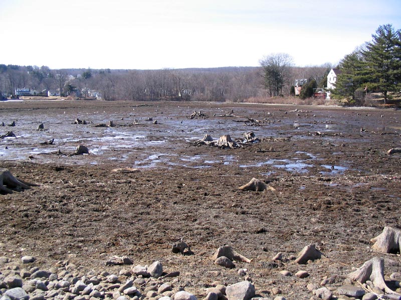
Depths are shallow at the reservoir's northern end, where the entire bottom is now visible.
Along the eastern border, the reservoir's exposed bed is mostly rocks with some sandy areas.
Islands on the West side of the reservoir near the Mill Street beach have temporarily become peninsulas.
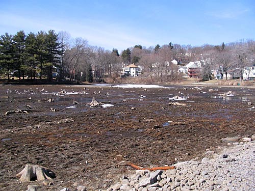
Next to the dam, work continues at the heavily contaminated former Coes Knife company site.
By summer, this site will have been cleaned up and turned into a mini-park.
There will be a semi-contiguous urban hiking path starting at the mini-park and connnecting with Columbus Park
via a walkway across the new dam. The path will then continue through newly acquired woodland next to the Knights of Columbus hall,
across Clark's Hadwen Arboretum, through the newly renovated Beaver Brook Park, and to the trail network at Newton Hill and Elm Park.
Progress at former Coes Knife Company site, with the southern end of Columbus Park in the background.
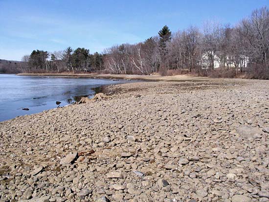
The receding water exposed two sunken cars and other debris which the city and neighborhood groups
hope to clean up before the reservoir is refilled this spring. Neighbors also hope that someday the shallower parts of the reservoir
will be dredged, further improving it's health.
How has all of this affected that pair of white swans that call the reservoir home? They seem to be doing just fine, and were spotted swimming
about in Coes Pond just below the reservoir dam.
 Coes Reservoir is located about a mile from campus and was originally constructed as a source
of water power for the former Coes Knife Company. The dam at the reservoir's southern end has
been at risk of failing for a number of years and is now being reconstructed. The reservoir's
water level has been drawn down by 5 feet for the dam reconstruction project, exposing much of
what normally lies beneath it's surface.
Coes Reservoir is located about a mile from campus and was originally constructed as a source
of water power for the former Coes Knife Company. The dam at the reservoir's southern end has
been at risk of failing for a number of years and is now being reconstructed. The reservoir's
water level has been drawn down by 5 feet for the dam reconstruction project, exposing much of
what normally lies beneath it's surface.
 Depths are shallow at the reservoir's northern end, where the entire bottom is now visible.
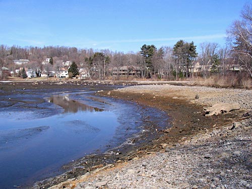 Along the eastern border, the reservoir's exposed bed is mostly rocks with some sandy areas.
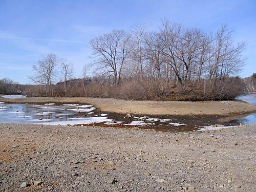
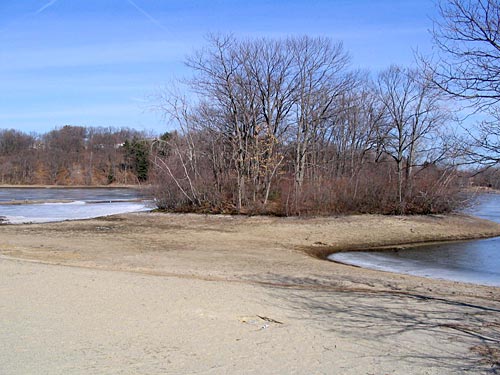 Islands on the West side of the reservoir near the Mill Street beach have temporarily become peninsulas.
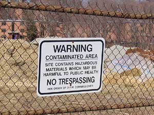 Next to the dam, work continues at the heavily contaminated former Coes Knife company site.
By summer, this site will have been cleaned up and turned into a mini-park.
There will be a semi-contiguous urban hiking path starting at the mini-park and connnecting with Columbus Park
via a walkway across the new dam. The path will then continue through newly acquired woodland next to the Knights of Columbus hall,
across Clark's Hadwen Arboretum, through the newly renovated Beaver Brook Park, and to the trail network at Newton Hill and Elm Park.
Next to the dam, work continues at the heavily contaminated former Coes Knife company site.
By summer, this site will have been cleaned up and turned into a mini-park.
There will be a semi-contiguous urban hiking path starting at the mini-park and connnecting with Columbus Park
via a walkway across the new dam. The path will then continue through newly acquired woodland next to the Knights of Columbus hall,
across Clark's Hadwen Arboretum, through the newly renovated Beaver Brook Park, and to the trail network at Newton Hill and Elm Park.

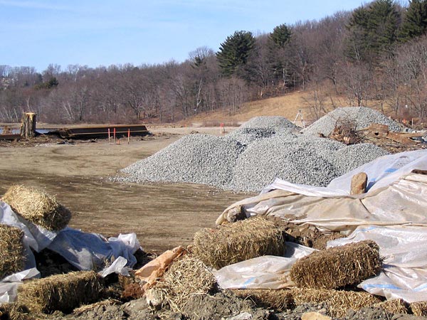 Progress at former Coes Knife Company site, with the southern end of Columbus Park in the background.
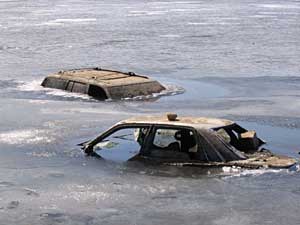 The receding water exposed two sunken cars and other debris which the city and neighborhood groups
hope to clean up before the reservoir is refilled this spring. Neighbors also hope that someday the shallower parts of the reservoir
will be dredged, further improving it's health.
The receding water exposed two sunken cars and other debris which the city and neighborhood groups
hope to clean up before the reservoir is refilled this spring. Neighbors also hope that someday the shallower parts of the reservoir
will be dredged, further improving it's health.
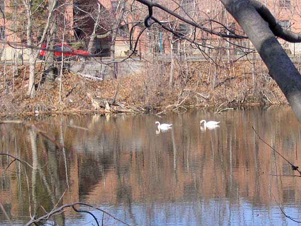 How has all of this affected that pair of white swans that call the reservoir home? They seem to be doing just fine, and were spotted swimming
about in Coes Pond just below the reservoir dam.
How has all of this affected that pair of white swans that call the reservoir home? They seem to be doing just fine, and were spotted swimming
about in Coes Pond just below the reservoir dam.