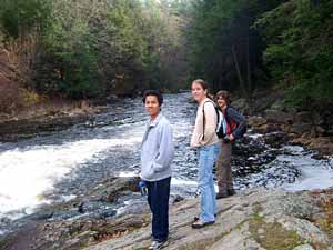
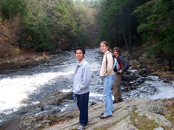
 Tuan, Hilary and Greg stand on the banks of the Ware River as it flows out of the flood control
gate at Barre Falls Dam. The dam - built by the Army Corps of Engineers to restict the river's flow
during heavy rains or spring runoff - is where our hike began.
Tuan, Hilary and Greg stand on the banks of the Ware River as it flows out of the flood control
gate at Barre Falls Dam. The dam - built by the Army Corps of Engineers to restict the river's flow
during heavy rains or spring runoff - is where our hike began.
|
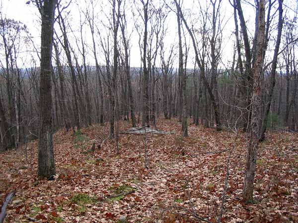
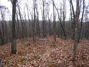 We proceeded south from the dam along the Midstate trail, shown here as it crosses over the top of Harding Hill.
It was the third time this fall that we found ourselves on a section of the 92-mile Midstate Trail, which runs from the
Rhode Island border to the New Hampshire border.
We proceeded south from the dam along the Midstate trail, shown here as it crosses over the top of Harding Hill.
It was the third time this fall that we found ourselves on a section of the 92-mile Midstate Trail, which runs from the
Rhode Island border to the New Hampshire border.
|
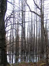
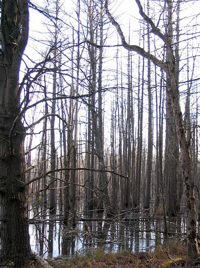
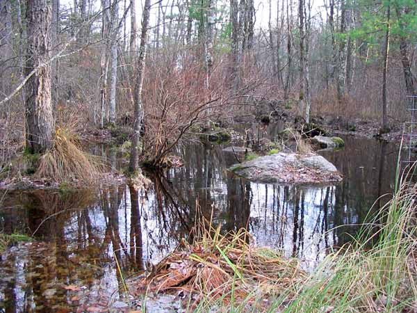
 Beyond Harding Hill, the trail descends past marshes and though swampy areas.
|
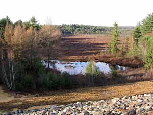 After about 3 miles, we parted from the Midstate trail and hiked across a dike at the
southern end of blood swamp. The dike allows water to be retained in the swamp during
periods of flooding until it can be safely released downstream through the dam.
After about 3 miles, we parted from the Midstate trail and hiked across a dike at the
southern end of blood swamp. The dike allows water to be retained in the swamp during
periods of flooding until it can be safely released downstream through the dam.
|
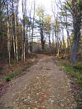
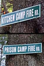 Our return trip back to the dam was along a network of fire roads with odd names. At an intersection,
we took Kitchen Camp Fire Road rather than find out where the alternative might lead us.
Our return trip back to the dam was along a network of fire roads with odd names. At an intersection,
we took Kitchen Camp Fire Road rather than find out where the alternative might lead us.
|
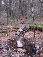
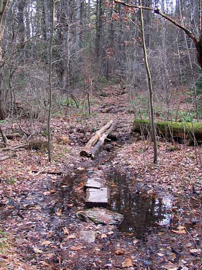
 We passed by this stream, which flowed through a culvert beneath the fire road.
.
We passed by this stream, which flowed through a culvert beneath the fire road.
. |
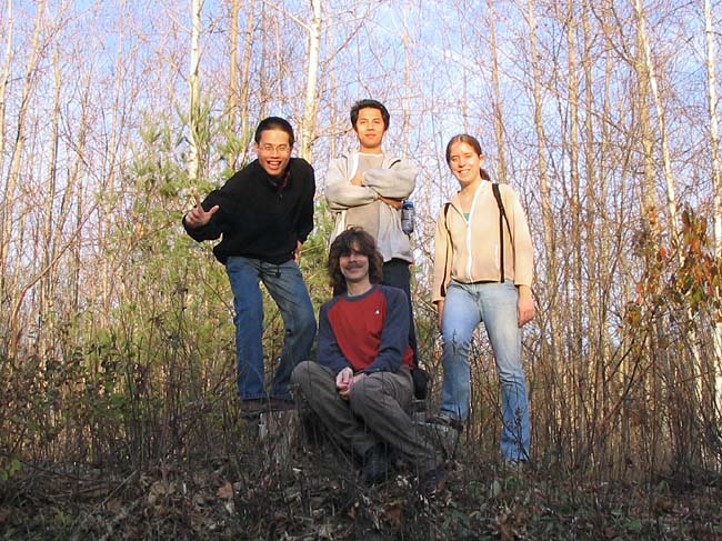
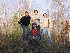 Illuminated by the setting sun, Chih Wei, Greg, Tuan, and Hilary pause for a tree stump photo op as we near the end of our hike.
|
[Back to Past Events] [Home]
|
 Tuan, Hilary and Greg stand on the banks of the Ware River as it flows out of the flood control
gate at Barre Falls Dam. The dam - built by the Army Corps of Engineers to restict the river's flow
during heavy rains or spring runoff - is where our hike began.
Tuan, Hilary and Greg stand on the banks of the Ware River as it flows out of the flood control
gate at Barre Falls Dam. The dam - built by the Army Corps of Engineers to restict the river's flow
during heavy rains or spring runoff - is where our hike began.
 We proceeded south from the dam along the Midstate trail, shown here as it crosses over the top of Harding Hill.
It was the third time this fall that we found ourselves on a section of the 92-mile Midstate Trail, which runs from the
Rhode Island border to the New Hampshire border.
We proceeded south from the dam along the Midstate trail, shown here as it crosses over the top of Harding Hill.
It was the third time this fall that we found ourselves on a section of the 92-mile Midstate Trail, which runs from the
Rhode Island border to the New Hampshire border.
 Beyond Harding Hill, the trail descends past marshes and though swampy areas.
 After about 3 miles, we parted from the Midstate trail and hiked across a dike at the
southern end of blood swamp. The dike allows water to be retained in the swamp during
periods of flooding until it can be safely released downstream through the dam.
After about 3 miles, we parted from the Midstate trail and hiked across a dike at the
southern end of blood swamp. The dike allows water to be retained in the swamp during
periods of flooding until it can be safely released downstream through the dam.
 We passed by this stream, which flowed through a culvert beneath the fire road.
.
We passed by this stream, which flowed through a culvert beneath the fire road.
. Illuminated by the setting sun, Chih Wei, Greg, Tuan, and Hilary pause for a tree stump photo op as we near the end of our hike.